Back in 2020, a group appeared on Facebook called Save Our Nerang Forest Trails, born out of the Queensland Parks and Wildlife Service closing two gravity trails in the Park without consultation. The folks behind the group and the local mountain bike club had learned of a broader scheme to shut down a substantial amount of trails that have been in Nerang forest for nearly 30 years.
The plan has now come to fruition with a new Draft plan of Management out for Nerang intending to close off the back half of the forest.
This Draft Plan has been endorsed by QPWS and local MPs in the Gold Coast Bulletin, framing it as “The city is to get its biggest network of mountain bike tracks…” when in fact, the plan would see more than 30km of legacy singletrack shuttered.

This document makes mountain biking out to be the primary threat to all ecological and cultural values within the park, seemingly underpinned by incomplete information.
Needless to say the local mountain bike community isn’t satisfied with what’s being presented. Neither are the Traditional Owners nor the hikers or trail runners who use Nerang National Park. So, what’s happening here? Let’s dive in.
But before we do, I (Colin) should note straight from the get-go, that Flow’s Queensland HQ is on the Gold Coast, and Nerang is what you could consider this writer’s home trails.
Related:
- Where The Green Meets The Gold, Riding On The Gold Coast | Part 1 Nerang, QLD
- Flow Destination Hub | Gold Coast, QLD
How did we get here?
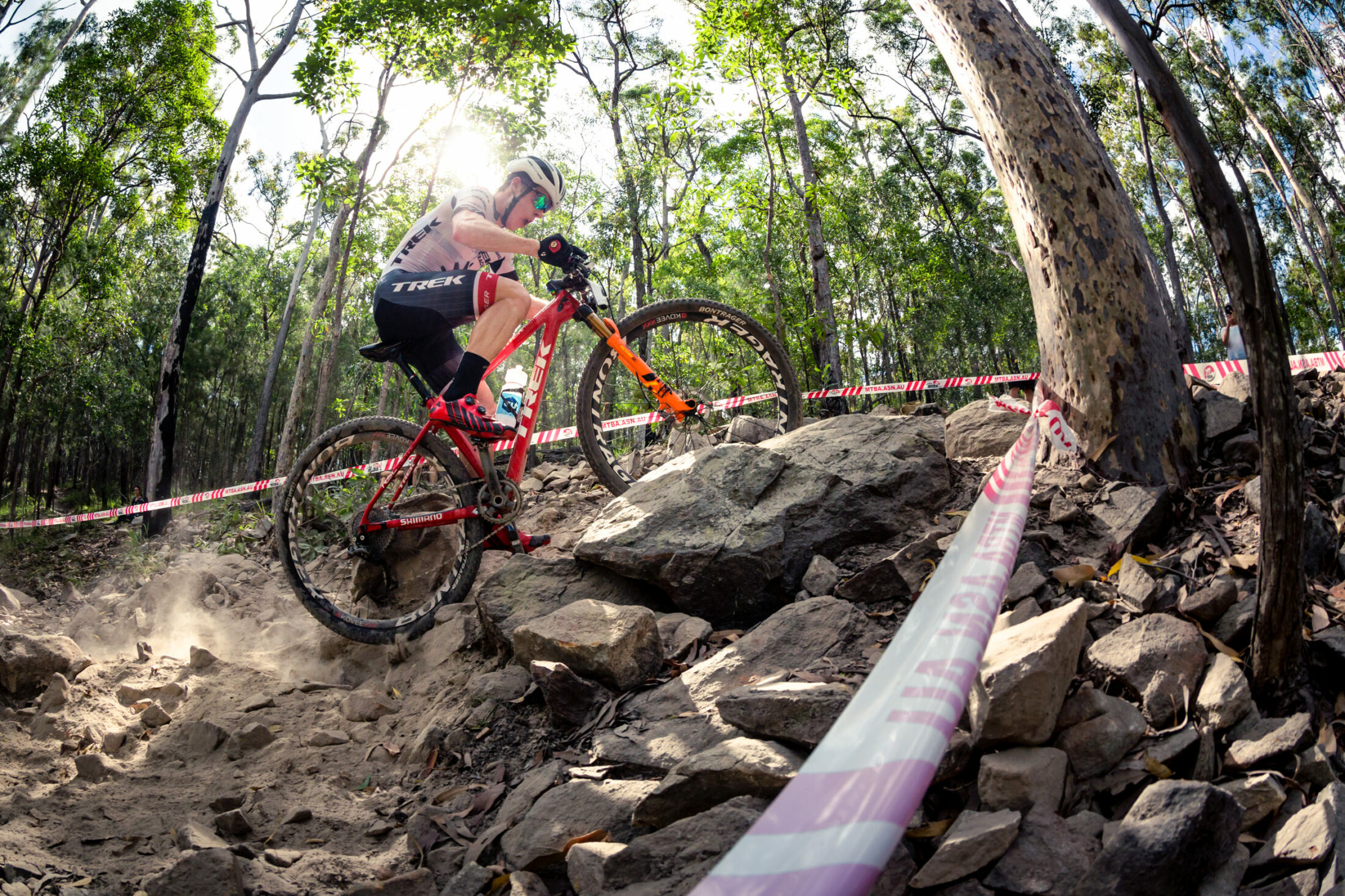
Nerang is a massive green patch surrounded by suburbia on all sides except for one, where there is a quarry. Within that green patch, there are multiple ecosystems and some breathtaking bits of forest, so it’s no surprise that folks on foot and two wheels flock there from up and down the coast.
Mountain biking in Nerang is not dissimilar to Royal National Park in that nobody really knows when it started, however, records from the Gold Coast Mountain Bike Club go back as far as 1992 — well before the land was gazetted as a national park from 2007 to 2009.
But it is not the first time access for mountain bikers has been in jeopardy. In the mid-1990s, an event was held in the forest when it was wet, causing some friction with the land manager. Years later, the late Peter Hallinan, who was the president of the GCMTB Club at the time, took the Queensland Department of Environment and Science to court over attempts to lock mountain bikers out. The result was the construction of the green-rated Casuarina Grove Circuit near the trailhead.

In the leadup to the Commonwealth Games on the Gold Coast, again, there was a barny with QWPS regarding the venue for the XCO event. Initially, the race was to be held at Hinze Dam, but the dam wall was in the midst of an upgrade. Being the drinking water supply for the Gold Coast, there was way too much red tape to build a venue and host an international event.
“The Commonwealth Games Committee basically steamrolled Parks to construct the Commonwealth Games Tracks as we know them,” says current GCMTB Club Secretary and Enduro Director Dave Hanson.
“That’s always sort of rolled out as, “the mountain bike community already got circa $3-million AUD,” even though the Club was not consulted much, if at all, only one of those three trails is still readily used by the general public, and a significant amount of that money was spent on the access ramp adjacent to the driveway as you come in off the street,” says Hanson.
“It’s an amazing facility for our juniors and racers, but it’s not the most valuable asset in the park,” he says.
That led to Parks commissioning Dirt Art to conduct a trail audit. While a handful of trails were recommended for closure as they weren’t often used, were duplicates or not sustainable, the overarching takeaway from this report was the network, on the whole, was well-built on good alignments.
“It was a comprehensive audit, and in terms of what I found, the quality was generally pretty good in terms of the trail alignments themselves. The average gradient was pretty sound, and the construction was to an acceptable standard in terms of minimal disturbance,” says Jason Lam, from Dirt Art, who completed the report. “There were a couple of exceptions in the form of timber features like old log rides and timber bridges, but the trails were pretty good on the whole.”
This trail audit accounted for 74.7km of trail, only 20km of which is formalised. It recommended 49.1km to be formalised, 5.6km for closure and 8.8km of new link trails at an estimated total cost of $996,325 AUD. It seems Queensland Parks never intended to release this report, as it only came to light after the GCMTB club lodged a Right to Information Request. QPWS did have a version of this report published on its website for a while, however, those documents have since been taken down — thankfully, everything is available through the Internet Archive and the trail audit, cost estimate, trail construction specifications and remediation works list are accessible.

A prepared statement sent to Flow in response to a request for comment did not address questions as to why these documents were removed from the QPWS website.
After the trail audit, no follow-up ground-truthed environmental or cultural heritage assessments were ever undertaken. Or if they were, nobody has seen them, and they aren’t cited in the new Draft Plan.
However, documents obtained by Flow allude to $750,000 AUD associated with a request to sanction a number of trails and close a few. Correspondence between a Senior Ranger and Principal Ranger for the Gold Coast roughly 12 months later is clarifying a QPWS position that it shouldn’t be formalising unsanctioned trails and asks, “if we aren’t going to formalise trails…are we expected to close them?”


Shortly after that, two gravity trails in the park — only one of which was flagged for closure in Dirt Art’s report — were bulldozed by Parks. The local riding community was miffed, that there had been little to no consultation or warning this was going to happen. Then Park’s larger plan to close off the back half of the forest came to light.
“Off the back of Norco Flow and Wimps being destroyed, we caught wind that Parks was trying to implement this plan of closing all of those tracks, and it seemed like they were going to do it without any sort of consultation at one point,” says Hanson.
The local media got involved. And so did politicians on both sides of the isle — there was an election looming — and the result was a co-design project. Meghan Scanlon, the MP for Gaven, where Nerang is located, secured $200,000 AUD for a collaborative project between parks, the MTB club, and the environmental groups to find a balanced solution for the Park.

The result was a black-rated gravity trail called Taipan and the closure of any unsanctioned or unsustainable trails built after the 2018 Dirt Art trail audit, or put simply, anything that doesn’t appear in the report.
“We have an email trail of every time we got minutes from the co-design that didn’t mention any of the Mountain Bike Club’s suggestions. We put in writing that we don’t agree with the minutes; this is what was said, and this is what we said. To be honest, the whole process was a bit of a sham,” says Hanson.
This co-design process is what forms the basis of the new Draft Plan for Nerang. The Gold Coast Mountain Bike Club nor the Nerang Trail Care Alliance are ever mentioned in the Draft Plan (they do feature in the resource info), however Friends of Nerang National Park get a shout out.


Hanson tells Flow the Club even went as far as putting together a draft design with a trail contractor which was submitted to Parks. None of what was laid out appears in the current Draft Plan.
Flow also reached out to MP Scanlon to find out why she has come out in support of this new Draft Plan, which contradicts what she stumped for back in 2020. MP Scanlon nor her office has replied to our request for comment.

What does the draft plan say?
The Nerang Area Draft Management Plan seeks to lay out the key environmental values in the park and how they can be managed. In every case, the primary threat is illegal mountain bike trail construction, with the threat level listed as “Very high.”
And to the Club’s credit, they have been united with Parks in trying to quash informal trail building in the park and have been quite successful in that goal in recent years.
The Draft divides Nerang into five zones, with no “Single MTB Track” to be allowed in Zone 2 — which is by far the largest. Park’s solution to this perceived threat of mountain biking and trail building is to reduce the trail network from 74km to about 32km. This plan would also remove about half of the existing Bailey’s trail, which QPWS recognises as legal. The Friends of Nerang National Park, which was started around the time this whole rigmarole kicked off, has also expressed displeasure with a trail called Explosions — which is sanctioned — being retained for its environmental sensitivity. We should note this trail buts up against the edge of a quarry.
“We understand that we can’t keep all the trails in there, and we’ve got two especially that we’d like to keep, but we’re also facing opposition groups who are basically trying to remove all mountain biking from the park, including some of the park’s existing, sanctioned trails,” says Hanson.
But the foundation of this Draft Plan seems to be shaky at best. Before Parks dives into the environmental aspect of the document, it speaks to the cultural elements of the landscape.


Draft management plan not supported by the Kombumerri Traditional Owners
After listing mountain biking as the primary threat to Aboriginal cultural values within the park, the Parks document lists its desired outcome as: “The relationship with the Nerang Area of the Yugambeh People, and the protection of their cultural heritage, will be managed by improved knowledge and partnership, recognising their connection to Country and their role in managing the park’s key values.”
Yugambeh is the regional language that connects the Traditional Owners between the Logan and Tweed Rivers, and several tribal clans call the region home. The Kombumerri lived off the land as the first people to occupy the Gold Coast, having been dated back over 20,000 years by the Australian National University.

However, it seems Parks chose not to involve the Kombumerri Traditional Owners until the last minute.
Justine Dillon is the Project Coordinator at the Ngarang-Wal Gold Coast Aboriginal Association and Secretary of its Board of Directors. She’s also in charge of the Kombumerri Rangers program, which among other things, manages the Guanaba Indigenous Protected Area located at the foot of Mount Tamborine. As part of the Kombumerri People, her family goes back generations on the Gold Coast.
Of the ten meetings during the co-design process, Dillon and the Kombumerri Traditional Owners were only invited to four of the ten sessions.
“When we finally got invited to meeting six, my first question was who did the cultural heritage (survey). They were like, “Oh we got the Native Title Body to come through.” I’m like, “How long did that take?” And they said, “Oh, the Cultural Heritage Body contracted it to this other body,” which I found out was a non-Indigenous entity that did the cultural heritage survey,” says Dillon.


Flow asked QWPS why the Kombumerri Traditional Owners were involved in less than half of the co-design sessions. In a prepared statement to Flow, a spokesperson said, “The documents were co-designed with the Traditional Owners for the area, the Kombumerri people, and representatives from the Danggan Balun Native Title claimant.’
Dillon tells us that the Native Title Body removed the Kombumerri representative, so they have no say in projects like this one for Nerang National Park.
“We have no spokesperson there, and they drive down from Logan (nearly 60km northwest) to dictate to all of us on the Gold Coast what they’re doing on our lands,” she says.


“We weren’t consulted or engaged. We would have done weeks of surveys, not one day or two days or less than a week. We would have been out there day and night surveying flora and fauna. No one from our side has been engaged to do that. They have just ticked their box of engagement (with the Native Title Body). It’s very tokenistic, and I called them out for it on day one,” she says. “It’s a kick in the guts for us as well as the community.”
Parks did not answer our questions about who conducted the cultural heritage assessment.
But the shaky foundation of this Draft Management Plan doesn’t stop here.
Parks to close trails based on inferred information
By Park’s own admission in the summary of key values, the confidence in condition assessments and confidence in trend assessment for the three ecological zones in the plan are listed as “limited,” seemingly because no ground-truthed ecological assessment has taken place. If one has taken place, it’s not cited in this document. Even more interesting, the confidence in the condition and trend assessments of the “mountain bike riding experience” is listed as “inferred.”
When we spoke to Lam from Dirt Art, he flagged this use of inferred data. We should also note that as part of the trail audit, which is not cited anywhere in this Draft Plan, Dirt Art conducted face-to-face and online community consultations in addition to mapping and assessing the trail network.

“I thought it was interesting. If the data you’re getting is all inferred about the actual user group, and then you’re going ahead and closing all the trails, is that a completely informed decision?” he says.
Flow reached out to the QPWS to clarify what information these inferences about the mountain bike experience are based on, and why assessments are being established on limited or incomplete information. The prepared statement did not address this question, nor why the trail audit is not cited in the Draft Plan.

But it also seems that some of the peer-reviewed studies which are used to nominate mountain biking and unsanctioned trails as the primary threat vector to every ecological community in the park have been mis-cited or taken out of context.
For example, the Primary Threat bullet point for the lowland rainforest and Coombabah Lake wetland area is basically identical but with the corresponding ecological community pasted in.
It says: “The illegal construction of mountain bike tracks through wetland and riparian areas are causing the following direct and indirect impacts as substantiated by other mountain bike trail impact research across the world (Lathrop 2003, Marion & Wimpey 2007, Quinn & Chernoff 2010): effects on water, including increased sedimentation and turbidity, and introduction of nutrients, pollutants or pathogens; effects on soils, including compaction, incision, erosion and trail widening to avoid muddied or puddled areas; and effects on vegetation, including vegetation removal, trampling and facilitation of encroachment by invasive species and pathogens (Pickering & Hill 2007). Threat rating: Very high.”
In that first citation, Quinn and Chernoff point out that mountain biking and mountain bike trails have a similar environmental effect to other forms of “summer season” trail use and that terrain solid time and the amount of moisture have the greatest influence on this effect.


However at the end the paper concludes: “…Since many of the environmental effects are known to vary according to regional geophysical traits, applying research carried out in other biomes and landscapes may be problematic. Similarly, there are few studies outside of mountainous and high-relief terrain areas; 3) No specific research has been published on the water-related environmental effects of mountain biking…”
Quinn and Chernoff’s study is a literature review in a Canadian context, and to borrow their words, “applying research carried out in other biomes and landscapes may be problematic.” The next article cited, written by Jason Lanthrop is looking impact of trails in the context of the US. Finally, while Marion and Wimpey do cite one study conducted in Australia, they focus primarily on studies conducted in North America. In summing up their literature review, the authors write:
“So what does this mean for mountain biking? The existing body of research does not support the prohibition or restriction of mountain biking from a resource or environmental protection perspective.”

We should note they also concluded that in 2007, when that literature review was conducted: “While land managers have long been concerned about the environmental impacts of mountain biking, there are still very few good studies published in peer-reviewed journals…As a consequence, the ecological effects of mountain biking on trails and natural resources remain poorly understood.”
To QWPS’s credit, Pickering and Hill’s study is Aussie, and Professor Catherine Pickering works at Griffith University on the Gold Coast. Their literature review finds that tourism activities and infrastructure — not just mountain biking, but hiking, camping, horse riding, and access roads — impact the environment, but more research is needed.
“Although the flora is internationally significant and protected area tourism is very popular, there is still limited research on direct and indirect impacts of tourism for many Australian plant communities. Based on this review, it is possible to identify future directions for research and recommendations for current research.”

What does the community think?
There are some definite cracks in the underpinning of the Draft Management Plan, but closing trails based on wobbly information doesn’t just hurt the mountain biking community.
I met TJ Craig in Nerang at the trail junction where Elevator meets Bailey’s. An experienced hiker, he runs The Gold Coast Hiking Meetup Group, which boasts over 4,000 members.
“They’re planning to close all of this,” he said, pointing to the map. “Not just to cyclists but hikers and everybody. And based on the Draft Management Plan, it’s an absolute travesty. It’s really flawed, and there are lots of faults, to be honest with you.”
“As the population increases, we’re all just going to be congested in this little area. It’s not just mountain bikers that use it, but they are using mountain bikers as a scapegoat. Everybody else like myself, the hikers, the trail runners, it will affect those groups too,” he says.

Courtney Atkinson is a former Olympic Triathlete who has represented Australia in Beijing and London, and he’s also a three-time Xterra Australian champ. More recently, he’s turned to adventure sports – running the eight tallest peaks in Australia, Red Bull Defiance, and even raced The Redback this year.
Based on the Gold Coast, by his telling he’s probably spent half of his life running and riding in Nerang.
“I have actually been on the other side of a lot of things with Parks where I’ve gone, “No, I actually agree with Parks, there’s people out there doing the wrong thing.” But I’m on the trail side of this one. There is a lot of space out there, and there is a lot of legacy. If those legacy trails never existed, no one would know these places existed, because you wouldn’t be able to access them,” he says.
“I fully understand there is a conservation concern — the beautiful spots are the spots you want to protect. When you start to get into these conversations where there are going to be opinions and bias on every side, I think the goal is always defined by where is that mutual ground. I just hate to think that destruction is the answer,” says Atkinson.

Looking at it from a network function perspective, Lam sees this Draft Plan by Parks as short-sighted.
“I don’t think that Draft Plan offered a whole lot of solutions other than just closing a lot of trails. There wasn’t too much mention of what they are going to do to address the effect of closing those trails. Are they upgrading other trails or putting in new trails to meet that style,” he says.
Lam noted that since the trails are already built, it would make a lot of sense to get a consultant out in the forest to conduct an actual impact assessment to see what effect the trails in question are having on their environment.
“If there are areas that are really sensitive, are there alternatives to realigning a trail, or we can look at options like rock armouring or raised platforms. There are a few treatments you can put in place to mitigate potential erosion, runoff concerns or sediment and other impact,” he says. “I think you need to explore some of those avenues before you close trails.”


Lam then pointed to the example of Royal National Park.
“If you close 50km of trail, that comes at a huge financial cost, then the user groups and general community are no better off,” he says.
He also noted that informal trails are the result of there not being enough infrastructure to satisfy demand in the community — just look at Sydney.
It also warrants mention that conservation groups like Friends of Nerang National Park use many of these informal trails for the work they do in the park.
“I get a thrill from spotlighting in the park and contributing to the work that Friends of Nerang do,” says Hanson. “Everyone gets their kicks in different ways, and the idea that your recreating on these trails isn’t as important as what they use them for very exclusivist.”


GCMTB Club and Kombumerri Rangers band together for a balanced solution
The Gold Coast Mountain Bike Club hasn’t given up their fight for the trails in Nerang. While all of this was ticking over, in the background, the MTB club has entered into a Provisional Trail Plan with Ngarang-Wal and the Kombumerri Rangers to work together to create a detailed cultural and environmental survey of the trails and close anything problematic.

“The Club is a volunteer organisation, and we’re trying to be quite diplomatic and present a balanced solution on behalf of the thousands of people that ride and run there each month. It’s the only major network in the region, and it has taken an undue load, but it’s all we’ve got. So we’re focused on a management solution that meets that demand,” Hanson says.
Dillon with Ngarang-Wal and the Kombumerri Ranges wants to work with the mountain bikers to help share their knowledge and equip folks who are out riding and running on these trails to be stewards of the land.
“Our main goal as Rangers is covering the flora, fauna and any cultural artifacts. If we can educate and inform, we can get help with that. More people on the ground means more information to fuel our goals on Country,” she says.

“I think that this joint management plan is more than viable. We took that to the government and have said we want to do a shared approach with both our goals in this document to say “this is how we want to see the future of this space,” and we can make accommodations for both sides,” she says.
While other land managers like NSW Parks and Wildlife have updated its views on mountain biking to be more favourable — to which we’ve already seen movement as a result— Hanson fears Nerang is a test case for the rest of the state.
“A few researchers and conservation groups have basically singled out mountain biking as the boogie man. They see the previous government’s including ecotourism in the Nature Conservation Act as a major problem. Mountain biking has been bundled in with ecotourism which they see as an exploitation and undermining of that Act,” he says.

The Draft Management plan for Nerang National Park is open for public submissions until September 19. Hanson is sending out the Bat Signal to folks from the Gold Coast and beyond to take the time to fill out the survey to let QPSW know their thoughts. Eds note: please take the time to read it, hurling outrage without understanding isn’t constructive. The GCMTB club has also published resources to help you unpack and understand what you’re looking at.
Hanson also encourages folks to email Minister for the Environment Leanne Linard, Local member for Gaven Meaghan Scanlon. While numbers are important, make your submission your own and be polite. You can find all of this on the Gold Cost Mountain Bike Club website.